Shoal Creek Park
  • Home
  • Park Guides
    • Park Trails Map
    • Google Maps Hiker's Guide
    • Alabama Birding Trail-Appalachian Highlands
    • Park Rules
    • Park History >
      • Mahler Family >
        • Mahler Family Photo Album
        • Perry Hall
        • Mahler Diaries
        • 20th Century Pioneers
    • Plant Guide
    • Archeological Report
    • Photo and Video Gallery
  • News and Events
    • About the Foundation >
      • Construction
  • Contact Us
  • Support

The Mission of SCPF is to support Shoal Creek Park as a nature park.

We are a non-profit organization that advises the City of Montevallo City Council, raises funds to benefit the park and its visitors, and contributes to its maintenance and operation. 
- WEBSITE IS CURRENTLY BEING REFRESHED -
Trails
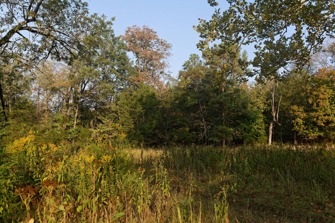
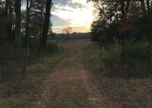
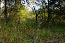
Shoal Creek Park boasts over 9 miles of hiking trails in the 167 acre park. Many of the trails link so you can combine them for your own Shoal Creek Park hiking experience. Enjoy wooded areas, fields, bridges, and creeks.
  • ​Betty Mahler Loop - 1.6 miles (Links - 0.33 miles)
  • Blue Trail - 1.55 miles (Links - 0.05 miles)
  • Cemetery Trail - .021 miles
  • Gold Trail - 0.9 miles (Links - 0.14)
  • Orange Trail - 1.1 miles (Links 0.89 miles)
  • Purple Trail - 1.2 miles (Links 0.92 miles)

Park Trails Map
Hiker's Guide 
Gather at the Park

The Pavilion

The park includes a pavilion with picnic tables and a view of the creek. There are also restroom facilities. The pavilion is fully accessible with a sidewalk from the parking lot.
The pavilion may be reserved for the following rates plus a $150 security deposit:
1/2 day (4 hours) – $40 (City Residents pay $25)
Full day (8 hours) – 
$80 (City Residents pay $50)
For reservations contact the Montevallo City Hall at 205-665-2555.
Enjoy the Water
Shoal Creek winds throughout the park with small waterfalls all along the way. Dolomitic limestone bedrock is exposed at places along the creek and in gullied areas of the fields. Bring a blanket and enjoy a picnic with a truly breathtaking view.
​You can walk along the creek in many places in the park or enjoy it from one of the  bridges along the trails. Two bridges connect visitors to the Betty Mahler Loop. The Mahler Bridge was installed in March 2019. The Frank Arnold Bridge was lovingly donated by the Arnold Family in his memory in June 2019.

Waterfalls and Creeks


Picture

Find us. Explore the Park.​​

Shoal Creek Park is located in Shelby County, approximately 30 miles south of Birmingham and approximately 8 miles from the Shelby County Airport exit off Interstate 65.
Driving Directions:  Take Interstate 65 South to Exit 234, the Shelby County Airport Exit. Turn left at the end of the ramp – this becomes Highway 12. Go 1.5 miles where Hwy 12 dead-ends at County Road 22. Turn right on County Road 22. Go 3.0 miles to the traffic light at Highway 119 South. Turn left on Highway 119 South. Follow Hwy 119 South past the American Village and the National Cemetery. Shoal Creek Park will be on your right.
Picture
271 HWY 119
Montevallo, AL 35115
Picture
[email protected]

The Park on Facebook

Please share your favorite park photos on Facebook!

Proudly powered by Weebly
  • Home
  • Park Guides
    • Park Trails Map
    • Google Maps Hiker's Guide
    • Alabama Birding Trail-Appalachian Highlands
    • Park Rules
    • Park History >
      • Mahler Family >
        • Mahler Family Photo Album
        • Perry Hall
        • Mahler Diaries
        • 20th Century Pioneers
    • Plant Guide
    • Archeological Report
    • Photo and Video Gallery
  • News and Events
    • About the Foundation >
      • Construction
  • Contact Us
  • Support